Hi Cheryl,
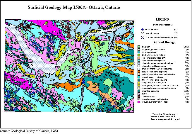
According to Surficial Geology Map 1506A, OTTAWA , Ontario - Quebec, 1982, the
proposed Lester Road site for the LRT is covered with "Fine-to medium-
grained sand, calcareous and commonly fossiliferous; nearshore sand generally
occurs as a sheet or as bars or spits associated with glaciofluvial materials".
The map also indicates abandoned river channels in the area, dating back to
the time when the Ottawa River was much larger than today - due to the melting
ice sheets from the last glaciation. The map also indicates three organic deposits;
two east of the old CPR tracks (now greatly reduced in size due to peat wastage
initiated by drainagefor housing developments) and one to the west of the tracks,
beyond the proposed LRT yards. These are excellent indicators of wetlands.
As indicated in topographic map 31 G/5, Ottawa, (and as you are already probably
aware), the land is sloping eastward from relatively flat area to the west.
The small stream that begins south of Windsor Park Village also flows to the!
east, eventually joining Sawmill Creek. (There should be fish in this stream).
The groundwater probably moves in an easterly direction also. If there were
any chemical spills, the toxic materials could get into the wetlands or ultimately
into Sawmill Creek.
As I have mentioned previously, there are large areas of old open meadows, prime
habitat for many meadow birds such as Meadow Larks, Bobolinks ,etc. These fields
are probably good hunting areas for hawks.
One thing that I and others have noticed on our way to visit the Medeola Woods,
is the apparently fairly high water table. Although the surface of the old fields
can be quite dry, the presence of Common Rush and Spiraea (wetland plants) in
slight depressions indicate a fairly high water table. Construction of the LRT
yard could affect the water table, which in turn, could negatively impact plant
communities east of the old CPR tracks.
Albert Dugal
